"Auyuittuq" is Inuit for "the land that never melts". A better name could not be found. Auyuittuq is home to the Penny Ice Cap, a 6,000 square kilometer ice cap that is one of the few remaining remnants of the most recent ice age.

|
Auyuittuq National Park is one of Canada's last wilderness paradises. Hikers, climbers
and campers who visit this northern park do not find manicured campsites and hot showers.
Instead they encounter challenge, solitude, a rich array of plant and animal life, and
the breathtaking grandeur of this remote arctic landscape.
"Auyuittuq" is Inuit for "the land that never melts". A better name could not be found. Auyuittuq is home to the Penny Ice Cap, a 6,000 square kilometer ice cap that is one of the few remaining remnants of the most recent ice age. | |
|
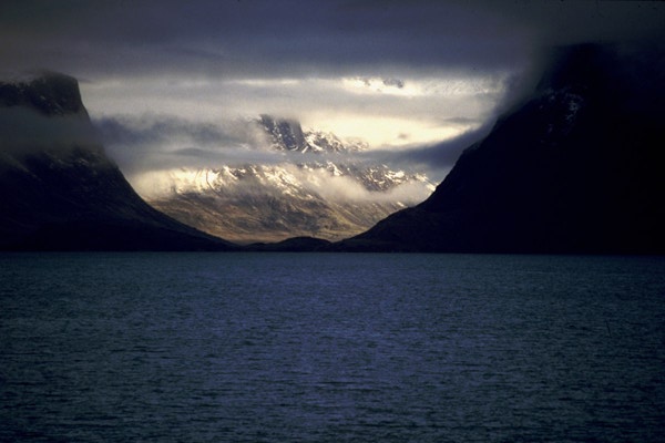
| Pangnirtung Fiord. The "entrance" to the park is via Pangnirtung Fiord. A one hour boat ride or a two day hike will take you from the town of Pangnirtung (where your plane landed) to Overlord at the head of the fiord. The fiord cuts deeply into Cumberland Peninsula and exhibits the traditional glaciated valley shape. |
|
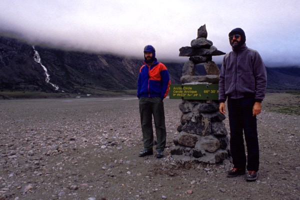
| The Arctic Circle. We had to stop for the obligatory self portraits when we reached the Arctic Circle. This "inukshuk" at 66.5 degrees north latitude marks this imaginary line. Its not cold out, just damp and quite windy. I kept my head and ears covered most of the time, otherwise, I got a headache from the wind whistling through my ears. |
|
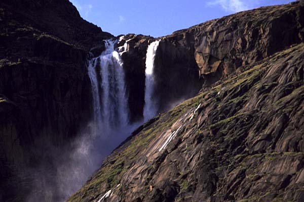
| Schwartzenback Falls. After leaving Overlord, the "trail" follows the east side of the Weasel River. The terrain is quite level and is mostly gravel, with a few "entertaining" stream crossings. After about five hours, you arrive at Windy Lake, a popular camping area. This is well named - the 3" x 10" beams anchoring the emergency shelter were vibrating like guitar strings. The VE-25 tent we used, was as tight as a drum and barely noticed the wind. This is the view of Schwartzenback Falls from our tent site. |
|
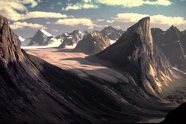
| Mount Thor. Mt Thor is one of the most distinctive landmarks within Pangnirtung Pass. Its on the east side of the Weasel River, about a four hour hike past Windy Lake. The 4000 ft shear cliff attracts climbers from around the world. With frequent rockfalls from the cliff, this is not an easy climb. There is another good camp site at the base of Thor, on the west side of the river. This view is from Tyr Peak, further up the valley. |
|
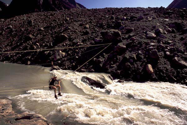
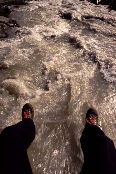
| Cable Car. Just before reaching Summit Lake, there is a cable crossing that allows you to get to the east side of the river. There's quite a flow of water draining out of the lake. The view from the centre of the cable span is inspiring. |
|
| Scary View. We each took our turn going out to the centre of the span just to have a look. I had my camera securely anchored to my chest, and I'm glad there was a "seat belt" in the gondola. |