Kluane National Park is one of Canada's most outstanding wilderness parks. At 22,000 sq.
km., it covers the southwestern corner of the Yukon territory centered on the Saint Elias
Mountains. Kluane was designated as a UNESCO World Heritage Site in 1979.
Kluane is a vast rugged wilderness. In the perpetual winter of the Icefield Ranges looms
Mount Logan, Canada's highest peak and world's largest massif. Amid the lofty mountains
lies a sea of ice from which massive tongues flow through the valleys. Kluane has the most
extensive nonpolar icefields in the world.
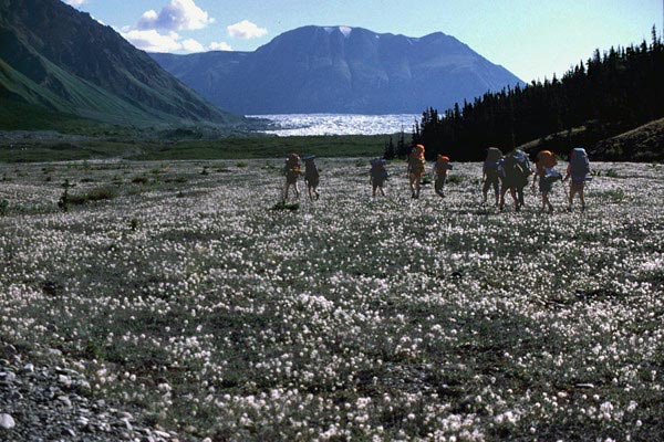
Our group chartered a helicopter to ferry us from Kluane Lake to the toe of the Kluane
Glacier. Starting at lake level, we climbed continuously up the Slims River valley until
we crested 10,000 ft. The views of glaciers and mountains were indescribable. I would
mortgage my future to repeat this flight.
|
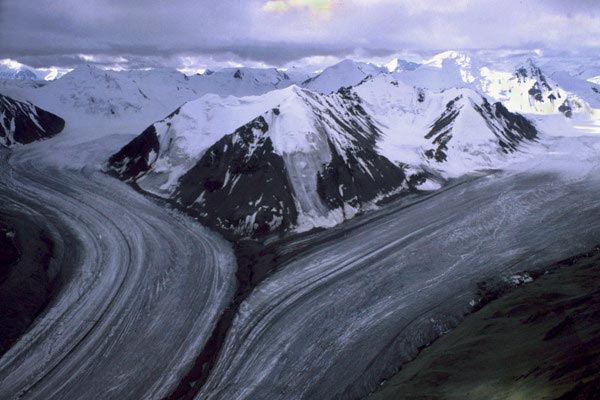
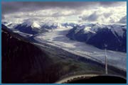
| Rivers Of Ice.
This is the Kaskawulsh Glacier, with Mt Kaskawulsh in the center. An aerial view graphically
verifies that glaciers are indeed rivers of ice. Here, the main glacier flow is intercepted
by the South Arm, producing a medial moraine in the process. Glaciers are seldom pure white -
if fact, they can get quite dirty from all the rock falls, and airborne dirt.
|
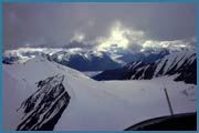
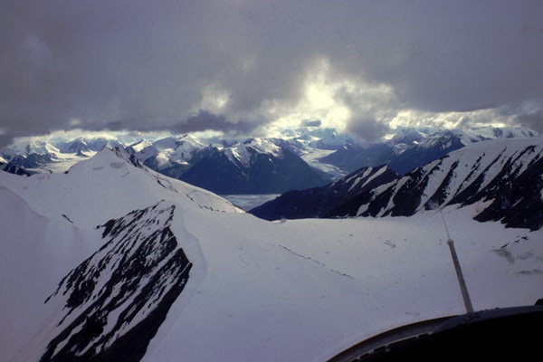
| Towards Kluane Glacier.
This is our first distant view of the Kluane Glacier. As you can see, it was an overcast
day, but the clouds only served to add to the drama. This glacier, as are all the others,
is fed by the several thousand square miles of icefields, that house Mt. Logan, Canada's
highest peak at 5950 meters.
|
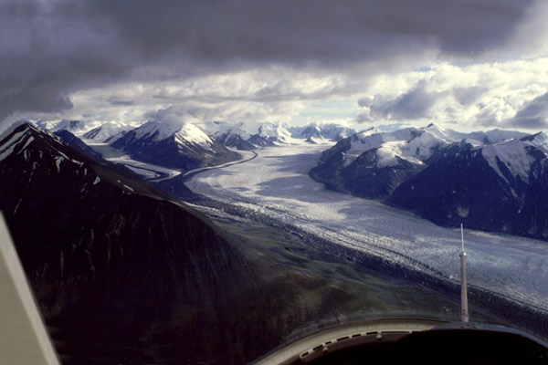
| Kluane Glacier.
This is our first clear view of the Kluane Glacier. It stretches back 15-20 miles to the
icefields. The lower reaches of the glacier are quite broken up, and would be impossible to
walk on. The glaciers generally move slowly, but every now and then, one will surge several
kilometers in a single season.
|
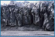
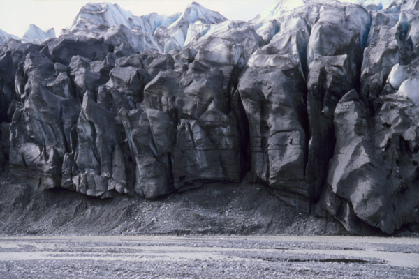
| Toe of Kluane Glacier.
The toe of the glacier consists of vertical cliffs that are several hundred feet high. You
can see how dirty the ice is from gravel ploughed up by the glacier as it moves downstream.
|
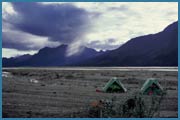
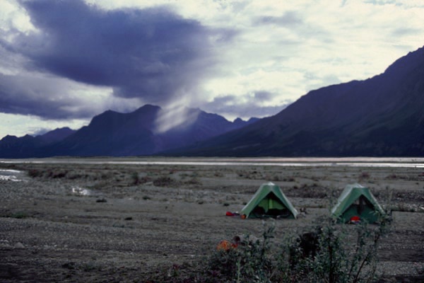
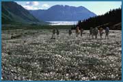
| Donjek Valley Campsite.
Our campsites were either on the gravel flats along the Donjek River or in the forested
areas at the sides of the valleys. Clean drinking water was always available from countless
streams coming down from the mountains. We were always on the lookout for grizzly bears -
we made a lot of noise going through forested sections, so that we wouldn't unexpectedly
surprise one.
|
| Towards Donjek Glacier.
This is our first good view of the Donjek Glacier. The glacier enters the Donjek Valley
from the west side, and occassionally dams up the Donjek River. This usually causes a
large lake to form, and eventually the lake pressure will push aside the ice with
catastrophic consequences.
|
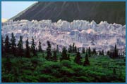
| Donjek Glacier.
This is the toe of the Donjek Glacier with some scenic foothills in the foreground. Its
hard to imagine something that big moving.
|
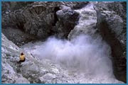
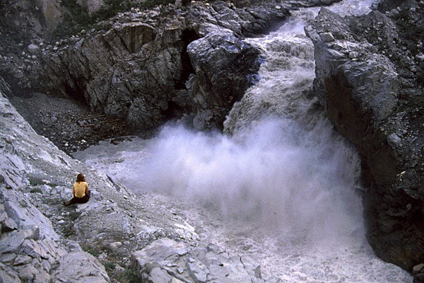
| Quiet Moments.
One of our campsites was near a falls in the Donjek River. The entire river came through
this narrow channel. It was a thunderously noisy location, but it was a good spot to sit
and contemplate life.
|